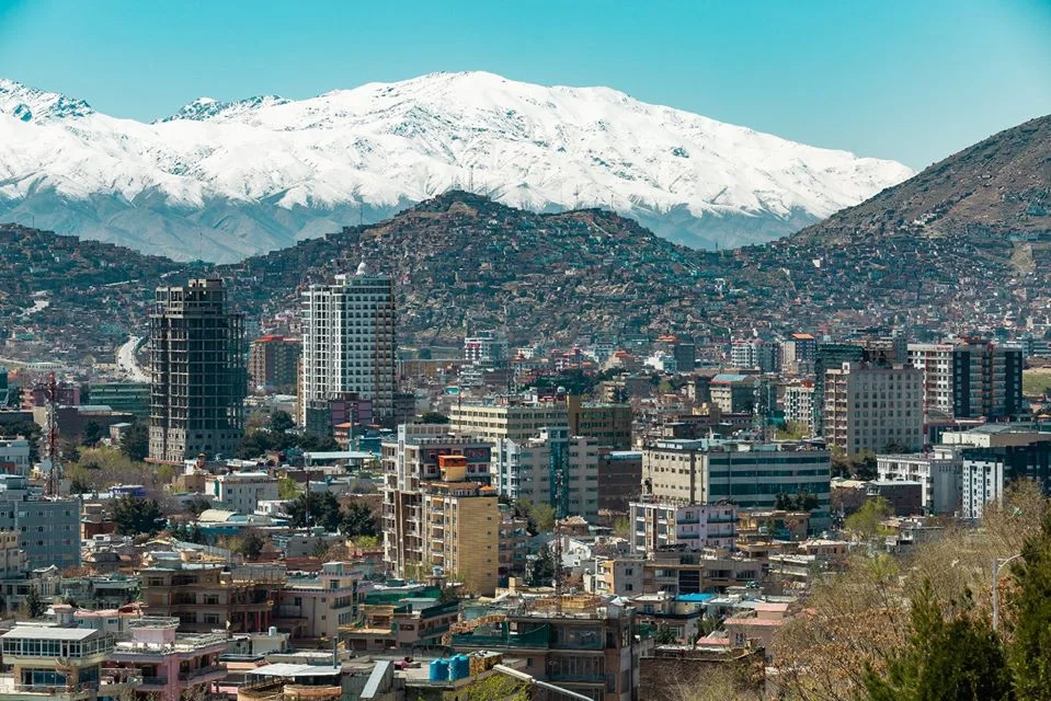
Central Afghanistan
Kabul
Bazaars, gardens and Afghanistan’s commercial and administrative centre.
Cities & towns
Kabul
Historic cities, extraordinary landscapes and new connections. Discover the places, people and traditions shaping Afghanistan’s story.
Hover over a province, or tap to explore its cities, landscapes and local character.
34 provinces · Eight regions for exploring
Regional groupings are a guide, not administrative divisions. Relief is approximate. Highways, rivers, railways and the canal are simplified.
Bazaars, gardens and Afghanistan’s commercial and administrative centre.
Kabul
Afghanistan’s character is found in its mountain valleys, trading cities, craftsmanship and hospitality. Looking closely means seeing both its heritage and the work underway to connect communities, support agriculture and strengthen regional trade.
Discover architecture, landscapes, food and local life through an experience shaped around your interests. Thoughtful planning connects each place with the context that makes it meaningful.
Private visits & production support ↗Understand local requirements, assess practical needs and explore relationships across trade, logistics, agriculture and services. A clear picture of the market comes before a commitment.
Consultancy & business support ↗Explore the country with the local knowledge and practical support your plans need.
Discuss your plans ↗Band-e Amir: Sgt. Ken Scar / U.S. Army, public domain in the United States. Herat Citadel: Todd Huffman, CC BY 2.0. Kabul (2020): Weaveravel, CC BY-SA 4.0. Kandahar (2013): Karla Marshall / U.S. Army Corps of Engineers, public domain in the United States. Mazar-e-Sharif (2012): Sgt. Kimberly Lamb / U.S. Army, public domain in the United States. Jalalabad (2009): Qudratullah Khan, CC BY 3.0. Wakhan (2019): Benoît Vicart, CC0 1.0. Ghazni Citadel (2011): S.K. Vemmer / U.S. Department of State, public domain in the United States. Additional province photos, via Wikimedia Commons: Badghis: Richwade1234, Public domain; Baghlan: seair21, CC BY 3.0; Daykundi: عزت الله حیدری, CC BY-SA 4.0; Farah: Matt Peterson, CC0 1.0; Faryab: Stephen Olsen / PRT Meymaneh, CC BY 2.0; Ghor: Vida Urbonaite / Afghanistan Matters, CC BY 2.0; Helmand: U.S. Army Corps of Engineers, Public domain; Jawzjan: Marek Bero, CC BY-SA 3.0 Poland; Kapisa: Samuel Morse, U.S. Air Force, Public domain; Khost: Laura Goodgame, U.S. Air Force, Public domain; Kunar: Teddy Wade, U.S. Army, Public domain; Kunduz: M. Michael / Parpan05, CC BY-SA 3.0; Laghman: Usman Mansoor Ansari, CC BY-SA 4.0; Logar: S. K. Vemmer, U.S. Department of State, Public domain; Nimroz: M. Michael / Parpan05, CC BY-SA 3.0; Nuristan: Abdul Qahar Nuristan; edits by Yuriy75 and W.carter, CC BY-SA 3.0; Paktia: Fred W. Baker III, U.S. Department of Defense, Public domain; Paktika: Akbarzadran, CC BY-SA 4.0; Panjshir: Michael O’Connor, CC BY 2.0; Parwan: Jialiang Gao, CC BY-SA 4.0; Samangan: Monikajoannah, CC BY-SA 4.0; Sar-e Pol: Ahmad imami, CC BY-SA 4.0; Takhar: Shahramnabizada, CC BY-SA 4.0; Uruzgan: Cain S. Claxton, U.S. Army, Public domain; Wardak: Carl Montgomery, CC BY 2.0; Zabul: WatneyScience, CC BY-SA 4.0. Images resized, converted to WebP and cropped in their page layouts. The adapted Kabul image remains under CC BY-SA 4.0.
Weather: Open-Meteo. Population: 2024 NSIA estimates. Climate, terrain, peoples and crops: Wikipedia and its climate tables, the Naval Postgraduate School Program for Culture and Conflict Studies, FAO, UNDP and provincial profiles. Resources: USGS, Afghanistan Ministry of Mines and Petroleum, provincial mines offices and news reports. Many deposits are undeveloped.


